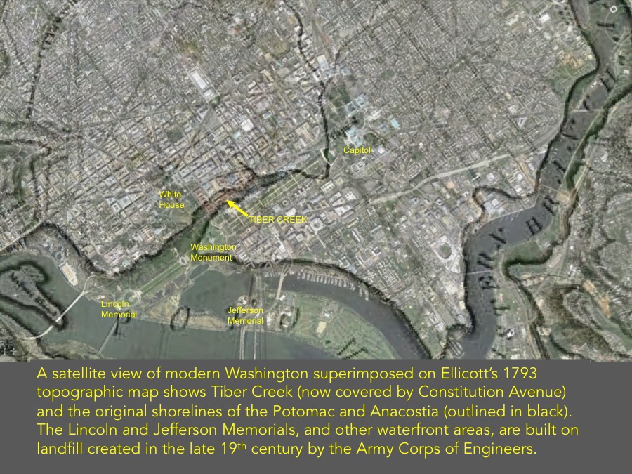
A satellite view of modern Washington superimposed on Ellicott’s 1793 topographic map shows Tiber Creek (now covered by Constitution Avenue) and the original shorelines of the Potomac and Anacostia (outlined in black).
A satellite view of modern Washington superimposed on Ellicott’s 1793 topographic map shows Tiber Creek (now covered by Constitution Avenue) and the original shorelines of the Potomac and Anacostia (outlined in black).
More Posts in