DC and Mall Flooding: A Struggle to Avoid Drowning

By Judy Scott Feldman

On Sunday, December 31st, The Washington Post published a deeply researched and eye-opening front-page story, “A struggle to avoid drowning,” plus five full pages more, about flooding in our nation’s capital. The story revealed an at-best mixed record of DC and federal agencies in addressing the urgent and growing threat throughout the capital.

The online version includes flood maps, illustrations of myriad buried creeks and streams, and photographs of historical and recent flooding to further explain the roots and continuing threat. A reconstruction of the Potomac River’s original shoreline shows the Lincoln Memorial stranded in the river and the African American Museum sitting atop Tiber Creek.

The Post has done DC residents and all Americans an invaluable public service. The National Mall Coalition has testified for years before the National Capital Planning Commission and Commission of Fine Arts about the need for a comprehensive flood plan for our capital and the Mall, only to be dismissed or ignored. And we have called for a commission that can help plan for the Mall’s future as more memorials, monuments, and museums are proposed and approved.

Now that The Post has alerted the public, how will Congress and the planning commissions respond? We’ve written to the Commission of Fine Arts and the National Capital Planning Commission asking for an answer.

The Coalition agrees with Ed Stierli at the National Parks Conservation Association whose letter in The Post says “It’s time for Congress to establish a commission focused on addressing the National Mall’s climate resilience . . . Federal agencies must stop the finger pointing and prioritize saving the National Mall for future generations.”

• Judy Scott Feldman is a founder and Chair of the National Mall Coalition


Photo Gallery: Devastating Floods are a Historic and Ongoing Problem for the National Mall

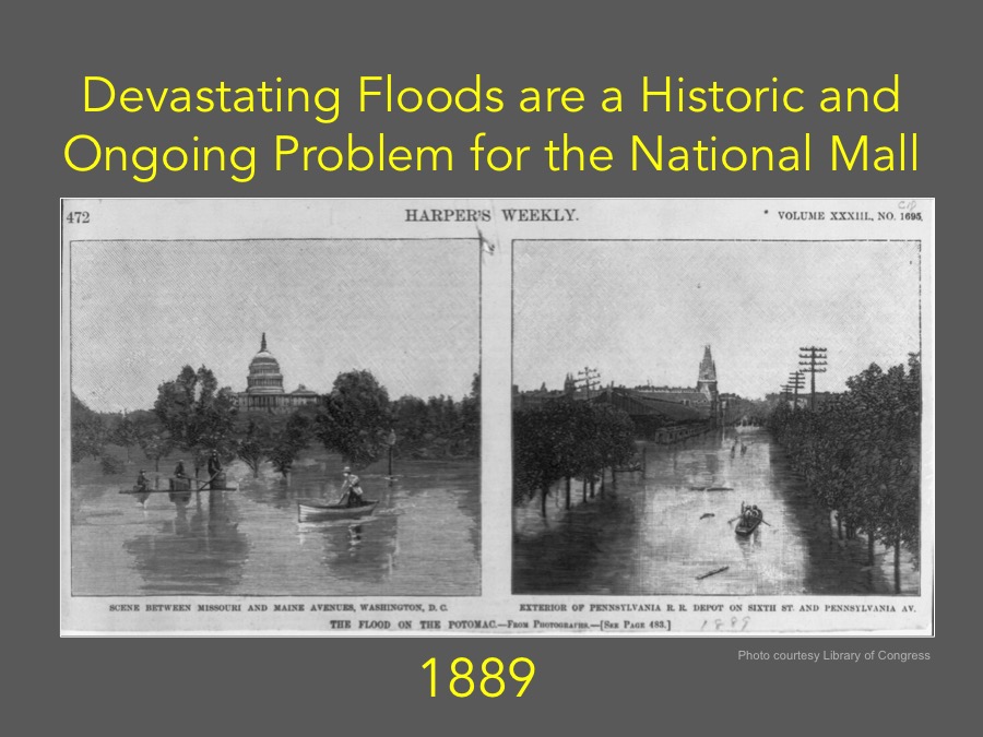
  • Devastating Floods are a Historic and Ongoing Problem for the National Mall (1889 Photo courtesy Library of Congress)
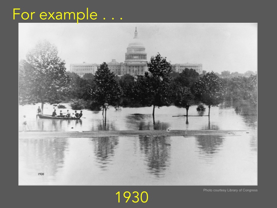
  • Devastating Floods for the National Mall (1930 Photo courtesy Library of Congress)
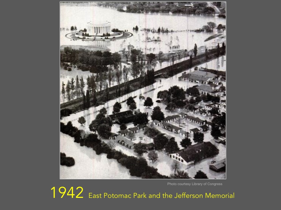
  • 1942 East Potomac Park and the Jefferson Memorial (Photo courtesy Library of Congress)
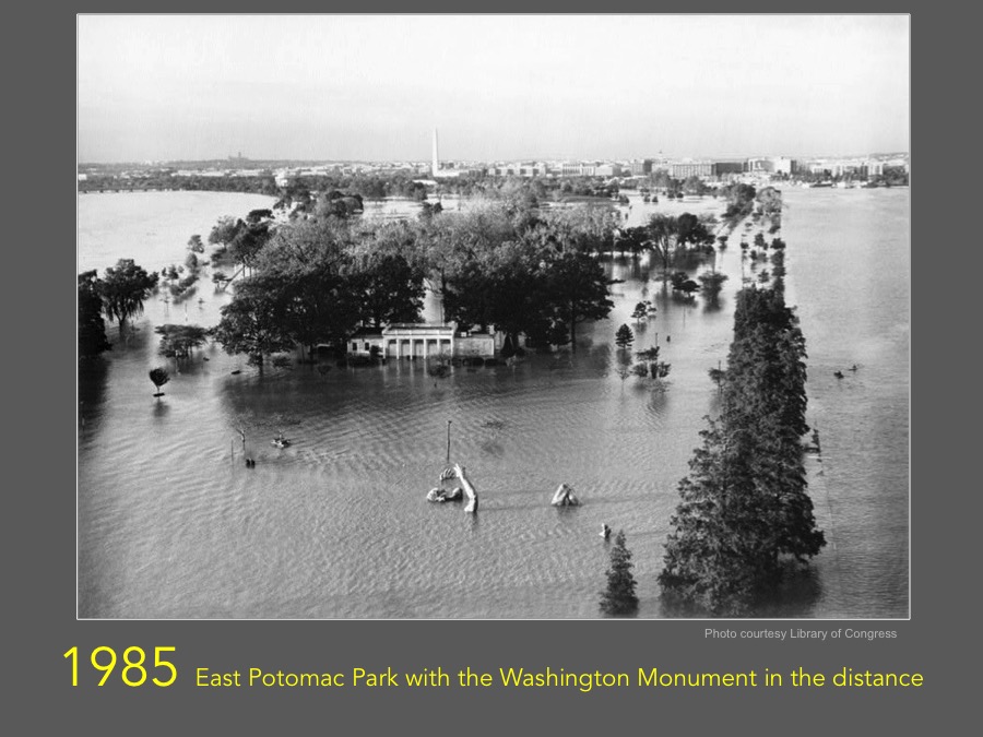
  • 1985 East Potomac Park with the Washington Monument in the distance (Photo courtesy Library of Congress)
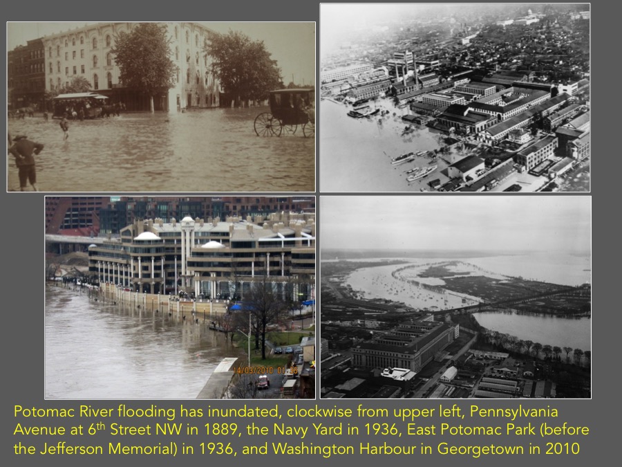
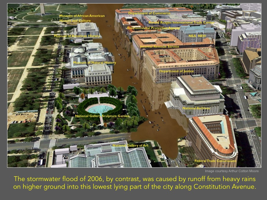
  • In fact, Washington has two separate flood threats: river flooding and stormwater flooding
  • Potomac River flooding has inundated, clockwise from upper left, Pennsylvania Avenue at 6th Street NW in 1889, the Navy Yard in 1936, East Potomac Park (before the Jefferson Memorial) in 1936, and Washington Harbour in Georgetown in 2010
  • The stormwater flood of 2006, by contrast, was caused by runoff from heavy rains on higher ground into this lowest lying part of the city along Constitution Avenue. (Image courtesy Arthur Cotton Moore)
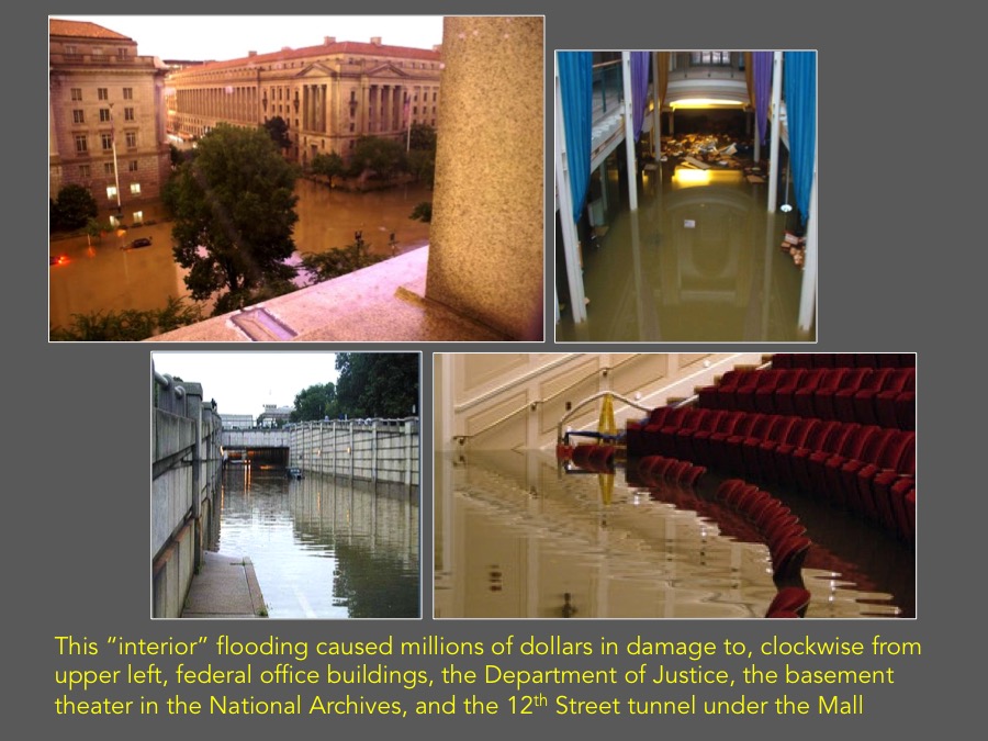
  • This “interior” flooding caused millions of dollars in damage to, clockwise from upper left, federal office buildings, the Department of Justice, the basement theater in the National Archives, and the 12th Street tunnel under the Mall
  • These flooding problems are the result of Washington’s topography and changes made to rivers and streams over the years
  • This 1793 topographic map by Andrew Ellicott shows the site chosen for the nation’s capital at the confluence of the Potomac and Anacostia (Eastern Branch) Rivers with a broad creek – Tiber Creek – wending its way along the Mall area from the Capitol to the Potomac
  • A satellite view of modern Washington superimposed on Ellicott’s 1793 topographic map shows Tiber Creek (now covered by Constitution Avenue) and the original shorelines of the Potomac and Anacostia (outlined in black).
  • This diagram illustrates that while the levee may prevent Potomac River flooding (the area outlined in red), it will not address the separate interior stormwater flooding problem.
  • No government action has been taken to address the ongoing stormwater flooding threat by implementing the recommendations of the 2011 Federal Triangle Stormwater Drainage Study sponsored by DC Water and the National Capital Planning Commission. Lacking a plan, Metro officials use sandbags to protect the Metro system from stormwater flooding.
  • Washington’s flood threats continue to be well documented in recent government and private studies but no comprehensive plan has been developed
 

Tags: